
Jeroen & Coco’s La Palma guide
Swimming at this side of the island
Although La Palma is not renowned for its beaches, there are some very special places to go for a swim. And even some secluded beaches around the corner, especially Puerto Trigo (aka Cala Misteriosa)! For the routes, see down here.
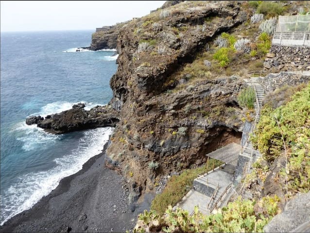
Playa Martin Luis is the first of the secluded beaches nearby, at just 6 minutes by car following the road down to the sea. With canopy and shower
https://goo.gl/maps/voJd13tXFf2s9c5H6
https://goo.gl/maps/72BB7Hk8YucWjVQH9

Cala Martín Luís
Playa Martin Luis is the first of the secluded beaches nearby, at just 6 minutes by car following the road down to the sea. With canopy and shower
https://goo.gl/maps/voJd13tXFf2s9c5H6
https://goo.gl/maps/72BB7Hk8YucWjVQH9
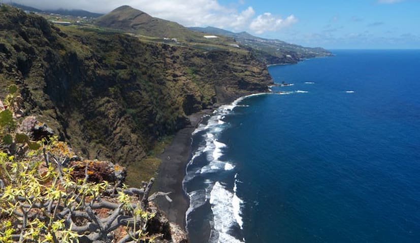
Best kept secet! Puerto Trigo is a unique secluded beach at only 10 minutes drive following the road down: https://goo.gl/maps/nxstnCj7tAaQ3eX99
Route: go down the road from your parking place all the way to the coast, and after ±10min drive there is a crossroad (and sign 'Puerto Trigo') where the road becomes one-direction and a light-yellow house is immediately on the right-side of the road: take a right and drive all the way to the end, where there is a small parking spot.
Cala misteriosa
7 LP-102Best kept secet! Puerto Trigo is a unique secluded beach at only 10 minutes drive following the road down: https://goo.gl/maps/nxstnCj7tAaQ3eX99
Route: go down the road from your parking place all the way to the coast, and after ±10min drive there is a crossroad (and sign 'Puerto Trigo') where the road becomes one-direction and a light-yellow house is immediately on the right-side of the road: take a right and drive all the way to the end, where there is a small parking spot.
One of the most impressive beaches of La Palma. But be aware of warnings/flag as the currents can be strong here.
https://goo.gl/maps/FVskA1J9hhQVyAE19
32 locals recommend
Playa de Nogales
One of the most impressive beaches of La Palma. But be aware of warnings/flag as the currents can be strong here.
https://goo.gl/maps/FVskA1J9hhQVyAE19
Santa Cruz city beach is very spacious, and just a 10 minutes drive (also by bus; stop at Castillete). For relaxed, safe swimming, or try Kite-surfing lessons (Kitesurfing La Palma) or having food and drinks on the city boulevard.
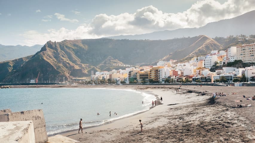
Castillete
Santa Cruz city beach is very spacious, and just a 10 minutes drive (also by bus; stop at Castillete). For relaxed, safe swimming, or try Kite-surfing lessons (Kitesurfing La Palma) or having food and drinks on the city boulevard.
Natural swimming bassins close to San Andres (beautiful village: see text further on)
https://goo.gl/maps/78iWxLxbVtZBrUNz9
30 locals recommend
Charco Azul
Natural swimming bassins close to San Andres (beautiful village: see text further on)
https://goo.gl/maps/78iWxLxbVtZBrUNz9
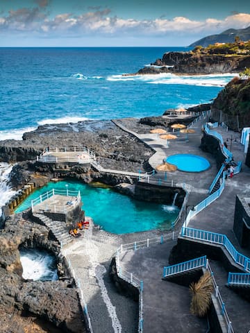
Big natural swimming pools in North-East of the island
https://goo.gl/maps/NNGnWgcARZrvbcvg9
10 locals recommend

Fajana Pools
3 C. la FajanaBig natural swimming pools in North-East of the island
https://goo.gl/maps/NNGnWgcARZrvbcvg9
Supermarkets
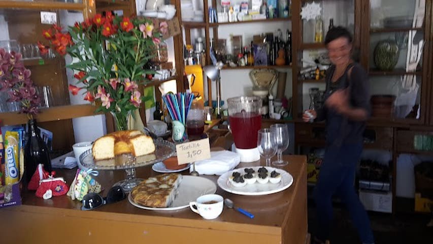
Buy local food in this historic market place
https://goo.gl/maps/pBNBor3YHQ7uSnUi8
12 locals recommend
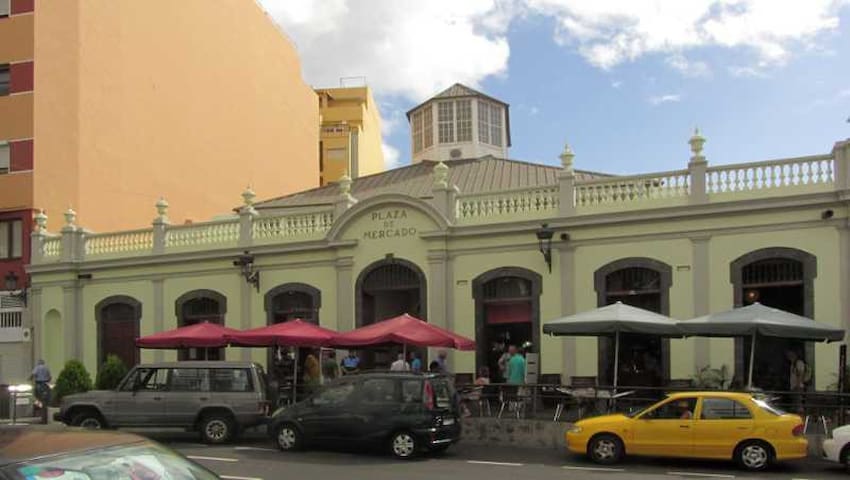
Santa Cruz de La Palma Market
16 Av. el PuenteBuy local food in this historic market place
https://goo.gl/maps/pBNBor3YHQ7uSnUi8
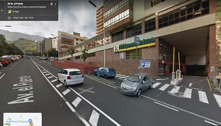
HiperDino El Puente
56 Av. el PuenteBig supermarket for everything you need
https://goo.gl/maps/tfrnZZLX9cxuZvvd9
SPAR
2 Calle Príncipe FelipeSmall supermarket nearby in Puntallana
https://goo.gl/maps/LWuERbE9MJtbNpY59
Saturday- & Sunday-morning market selling local products
https://goo.gl/maps/cag1WxJkaqQkxzx39
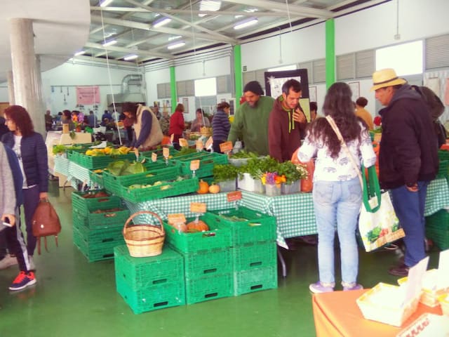
Mercadillo Municipal De Puntallana
1 C. la CamachaSaturday- & Sunday-morning market selling local products
https://goo.gl/maps/cag1WxJkaqQkxzx39
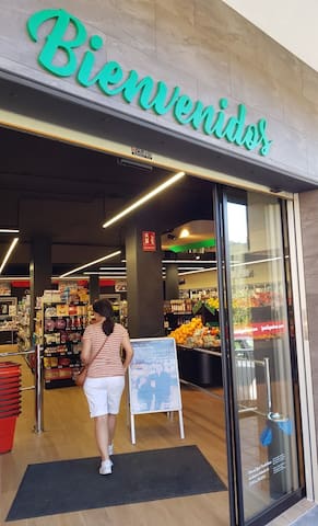
When arriving on Sunday (or with the late ferry), this small supermarket in Santa Cruz, opposite the Marina-harbor, is open (even from 5am-23pm) to get your essentials for breakfast etc.

SuperDino Los Indianos
When arriving on Sunday (or with the late ferry), this small supermarket in Santa Cruz, opposite the Marina-harbor, is open (even from 5am-23pm) to get your essentials for breakfast etc.
Both a Lidl & Mercadona supermarkets, which can be reached following the direction El Paso/Los Llanos (but just for 5 minutes and then turn around on the first overpass)

Lidl
Both a Lidl & Mercadona supermarkets, which can be reached following the direction El Paso/Los Llanos (but just for 5 minutes and then turn around on the first overpass)
Sightseeing & Walking
Peaceful little village worth a visit, also to walk to from and back to Santa Cruz via the lovely circular 'Ruta de los Molinos' / PR LP 02.2
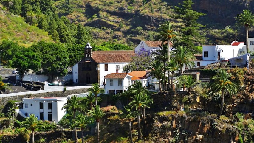
Las Nieves
Peaceful little village worth a visit, also to walk to from and back to Santa Cruz via the lovely circular 'Ruta de los Molinos' / PR LP 02.2
Very relaxed pretty village at the ocean front. Also walk from there via the easy foothpath to Charco Azul (see ‘Swimming’) and have a lunch or dinner in ‘Mesón del Mar’ in the little harbour/beach of Puerto Espindola
https://goo.gl/maps/6AJJXpqrugip9WrBA
8 locals recommend
San Andrés y Sauces
Very relaxed pretty village at the ocean front. Also walk from there via the easy foothpath to Charco Azul (see ‘Swimming’) and have a lunch or dinner in ‘Mesón del Mar’ in the little harbour/beach of Puerto Espindola
https://goo.gl/maps/6AJJXpqrugip9WrBA
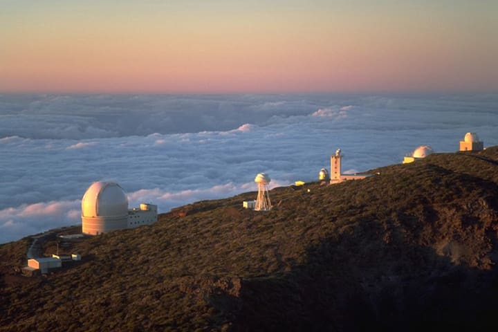
On top of the world, just next to a couple of the world's most advanced telescopes
89 locals recommend
Roque de Los Muchachos
Carretera al Roque de los MuchachosOn top of the world, just next to a couple of the world's most advanced telescopes
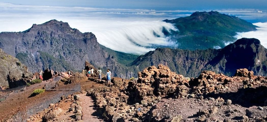
Parque Nacional de la Caldera de Taburiente is an impressive nature reserve for hiking. Note: just a limited amount of visitors (parking places) are allowed per day, so make your reservation here:
Go to website of the reservasparquesnacionales (.es) and click on ‘Caldera de Taburiente’ and then 'Booking a place for private car’, choose a timeslot and length of stay, fill out, and take print or digital document to show at the gate.
16 locals recommend

Mirador de la Cumbrecita
Carretera Caldera TaburienteParque Nacional de la Caldera de Taburiente is an impressive nature reserve for hiking. Note: just a limited amount of visitors (parking places) are allowed per day, so make your reservation here:
Go to website of the reservasparquesnacionales (.es) and click on ‘Caldera de Taburiente’ and then 'Booking a place for private car’, choose a timeslot and length of stay, fill out, and take print or digital document to show at the gate.
Perfect place to start one of the hiking trails on top of the islands mountain ridge (Cumbre)
https://goo.gl/maps/G3rp1FKNUGevyix56
9 locals recommend

El Pilar
Perfect place to start one of the hiking trails on top of the islands mountain ridge (Cumbre)
https://goo.gl/maps/G3rp1FKNUGevyix56
Go see the saltworks, but also the otherworldly volcanic landscapes and pools like Playa de Echentive or the hot spring Fuente Santa
36 locals recommend

Fuencaliente Saltworks
5 Ctra. la Costa el FaroGo see the saltworks, but also the otherworldly volcanic landscapes and pools like Playa de Echentive or the hot spring Fuente Santa
Viewpoint near the volcano and the lava-fields. Park the car at the road-sign and walk several minutes.
Another viewpoint further down the lava is possible from 'Montaña La Laguna'.

Mirador Oficial Tajogaite
Viewpoint near the volcano and the lava-fields. Park the car at the road-sign and walk several minutes.
Another viewpoint further down the lava is possible from 'Montaña La Laguna'.
Starting point of the well-known hike of 'La Galga' (PR LP 05.1) into the forest.
A few other good hiking routes at this side of the island are:
-'Barranco del Agua'; very nearby collection of hiking trails starting immediately behind the first tunnel you pass in the direction of Puntallana.
-'Ruta de las Fuentes' , PR-LP19 las Breñas, San Pedro
17 locals recommend

Cubo De La Galga (Fern Forest)
LP-1Starting point of the well-known hike of 'La Galga' (PR LP 05.1) into the forest.
A few other good hiking routes at this side of the island are:
-'Barranco del Agua'; very nearby collection of hiking trails starting immediately behind the first tunnel you pass in the direction of Puntallana.
-'Ruta de las Fuentes' , PR-LP19 las Breñas, San Pedro
(Note: temporarily closed due to rock-fall).
Beautiful nature reserve Bosque de 'Los Tilos'.
But besides seeing the waterfall, make the hike up to 'Mirador Espigón Atravesado' that takes you up to a spectacular view point above the tree tops.
For the real adventurous (and experienced) hikers, you must try to do the famous 'Nacientes de Marcos y Cordero' PR LP 06 route (rain jackets and helmets advised, as it takes you through many dripping water tunnels - also possible taxi-ride up to starting point 'Casa del Monte').
8 locals recommend

Los Tilos Waterfall
(Note: temporarily closed due to rock-fall).
Beautiful nature reserve Bosque de 'Los Tilos'.
But besides seeing the waterfall, make the hike up to 'Mirador Espigón Atravesado' that takes you up to a spectacular view point above the tree tops.
For the real adventurous (and experienced) hikers, you must try to do the famous 'Nacientes de Marcos y Cordero' PR LP 06 route (rain jackets and helmets advised, as it takes you through many dripping water tunnels - also possible taxi-ride up to starting point 'Casa del Monte').
Beautiful circular hike (PR LP 09. 2) in the northern part, from La Zarza to Don Pedro and back
15 locals recommend

Parque Cultural La Zarza
Carretera GeneralBeautiful circular hike (PR LP 09. 2) in the northern part, from La Zarza to Don Pedro and back
Starting point of a circular hike in the North-West, through a valley of dragon trees, follow signs with 'Cuevas de las Buracas' (or 'la ruta de los dragos'). It is part of the GR-130 (1).
If you want to stretch it, you can add the 'Lomada Grande' walk to it.
6 locals recommend

Cuevas de Buracas
8A Diseminado Buragas ClStarting point of a circular hike in the North-West, through a valley of dragon trees, follow signs with 'Cuevas de las Buracas' (or 'la ruta de los dragos'). It is part of the GR-130 (1).
If you want to stretch it, you can add the 'Lomada Grande' walk to it.
Driving up via the LP-4 to the top of the island, there is a car-park which is the starting point to walk up to 'Pico de la Nieve', for a spectacular view and hikes in both directions over the ridge of the island.

Pico de La Nieve
Driving up via the LP-4 to the top of the island, there is a car-park which is the starting point to walk up to 'Pico de la Nieve', for a spectacular view and hikes in both directions over the ridge of the island.
The PR-LP 13 is a challenging hike at the west-side, near Los Llanos. Best to take a taxi-ride from the car-park at the bottom of the (mostly) dry river-bed in the Caldera, up to the starting point at 'Los Brecitos'. The descent into the 'Barranco de las Angustias' brings you via the 'Cascada de los Colores' back to the car-park.

Mirador de Los Brecitos
The PR-LP 13 is a challenging hike at the west-side, near Los Llanos. Best to take a taxi-ride from the car-park at the bottom of the (mostly) dry river-bed in the Caldera, up to the starting point at 'Los Brecitos'. The descent into the 'Barranco de las Angustias' brings you via the 'Cascada de los Colores' back to the car-park.
Famous hike through impressive volcanic landscapes. This is a long (day) walk. Not too difficult, but for practiced hikers. If you start the GR-131/(etapa 3) at El Pilar (see above), after an initial light ascent from ±1500 to 1900m, the rest is a convenient descent all the way to Fuencaliente (where you take a taxi back to El Pilar).

Ruta de los volcanes
Famous hike through impressive volcanic landscapes. This is a long (day) walk. Not too difficult, but for practiced hikers. If you start the GR-131/(etapa 3) at El Pilar (see above), after an initial light ascent from ±1500 to 1900m, the rest is a convenient descent all the way to Fuencaliente (where you take a taxi back to El Pilar).
Challenging climb to a magnificent viewpoint from the Bejenado mountain. Either the PR LP 13.3 from the parking place at the end of 'Pista Valencia' (and try the circular route back via 'Roque de los Cuervos'), or from the Cumbrecita parking-place (reservation needed - see other link)

Pico Bejenado
Challenging climb to a magnificent viewpoint from the Bejenado mountain. Either the PR LP 13.3 from the parking place at the end of 'Pista Valencia' (and try the circular route back via 'Roque de los Cuervos'), or from the Cumbrecita parking-place (reservation needed - see other link)
Places for drinks & lunch
Bar La Garza in El Tablado (north), the most picturesque village of the island (make reservations beforehand www.lagarzalapalma.com)
El Tablado
Bar La Garza in El Tablado (north), the most picturesque village of the island (make reservations beforehand www.lagarzalapalma.com)
Instead of a sandwich at the airport, prior to your return flight, you go to this place next to the airport and enjoy grilled fish while sitting at the edge of the sea
36 locals recommend
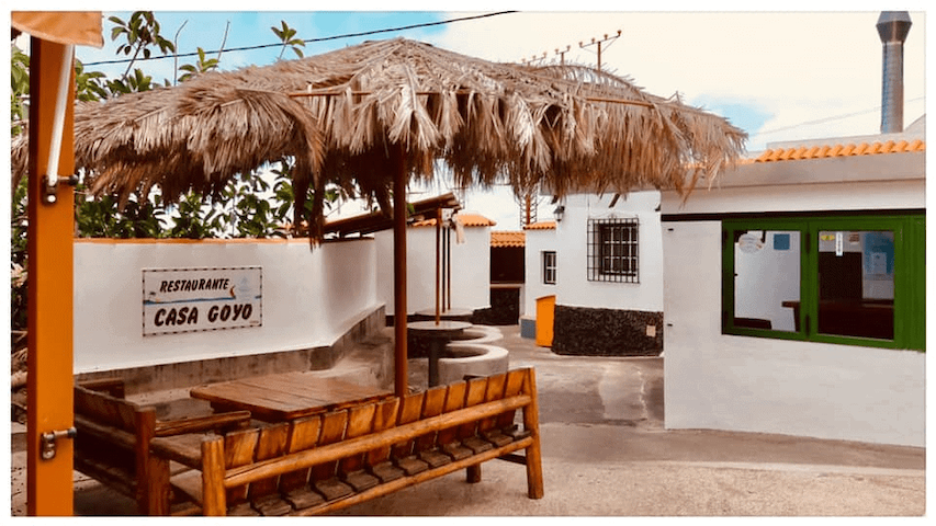
Casa Goyo
120 LoderoInstead of a sandwich at the airport, prior to your return flight, you go to this place next to the airport and enjoy grilled fish while sitting at the edge of the sea
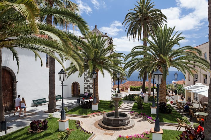
Great coffee place in the centre of Santa Cruz, awarded for serving one of the best coffees of Spain
8 locals recommend
El Cafe de Don Manuel (Alameda)
2 C. Anselmo Pérez de BritoGreat coffee place in the centre of Santa Cruz, awarded for serving one of the best coffees of Spain
Perfect place on beautiful square of San Andres (watch varying opening hours)
La Placita Food and Coffee
5 Calle Pl.Perfect place on beautiful square of San Andres (watch varying opening hours)
Sea-side restaurant in the North-East, next to the La Fajana natural swimming pools (see swimming). See website for opening hours https://lagaviotarestaurante.com/
Restaurante la Gaviota
0 Calle la FajanaSea-side restaurant in the North-East, next to the La Fajana natural swimming pools (see swimming). See website for opening hours https://lagaviotarestaurante.com/
A roadside bar/truck-stop-restaurant next to the Shell station, with good homemade pizzas or sandwich (and view) if you want to eat or take-away something simple within walking distance.

Cafetería Bella Vista
A roadside bar/truck-stop-restaurant next to the Shell station, with good homemade pizzas or sandwich (and view) if you want to eat or take-away something simple within walking distance.

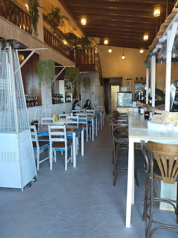
Bar El Baifo Street Food
Awarded 2023 for best hamburger in Spain

Bar Café Melchor 2.0
1 Calle Dr. Pérez CamachoGood place to have a drink or meal on the lively Alameda square
Restaurants at this side of the island
Where the special location and atmosphere is just as important as the uncomplicated food itself
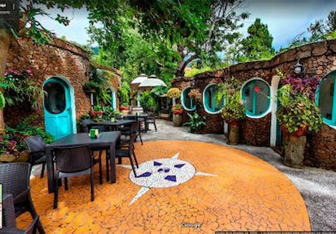
Chipi chipi
Where the special location and atmosphere is just as important as the uncomplicated food itself
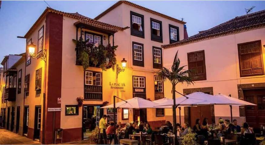
Restaurante la Placeta
1 Pcta. de BorreroGood food in the centre of Santa Cruz
Restaurante Mesón Del Mar
9 Cam. Puerto EspíndolaLively restaurant at the harbor & beach of Espindola near San Andres
IL GHIOTTONE bar ristorante pizzeria
4 Avenida MarítimaItalian food on the ocean boulevard
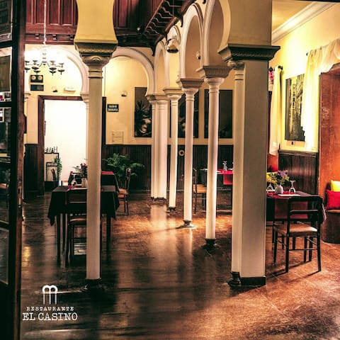
Restaurante El Casino Santa Cruz de La Palma
15 Calle Anselmo Pérez de BritoDining in stylish old casino

Restaurante Casa Osmunda
2 Subida al Mirador de la ConcepciónHighly praised restaurant

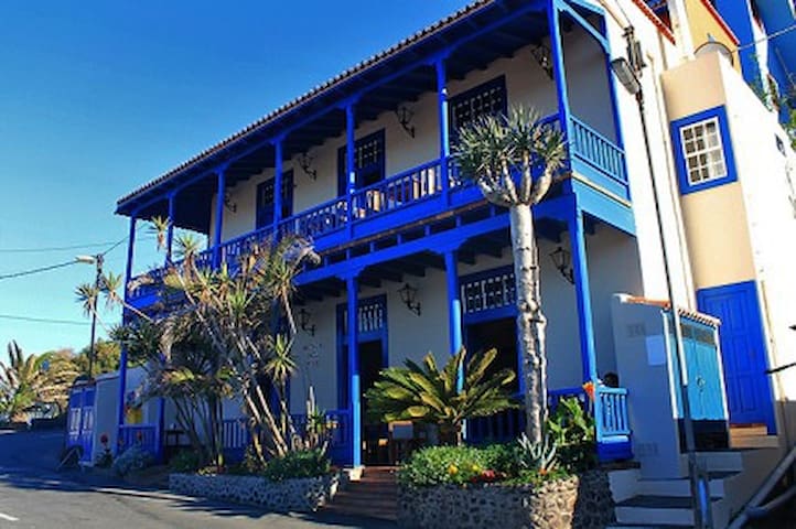
Restaurante Lucy
Good (Italian/Fish oriented) restaurant with view over harbor

Jazmine Thai Restaurant
Thai food in Mazo
For tapas, food & drinks within walking distance (50 meters from Shell station & Bella Vista diner)

Guachinche Suancar & Bea
For tapas, food & drinks within walking distance (50 meters from Shell station & Bella Vista diner)
Activities
Watching dolphins, and maybe whales, on a boat with underwater vision or go for a sailing trip https://fancy2.com/en/
6 locals recommend

Fancy II
Watching dolphins, and maybe whales, on a boat with underwater vision or go for a sailing trip https://fancy2.com/en/
Kitesurfing from the beach of Santa Cruz
https://m.facebook.com/pages/category/Sports/Kitesurfing-La-Palma-1527421200714560/
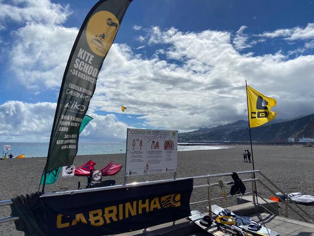
Avenida Marítima
Avenida MarítimaKitesurfing from the beach of Santa Cruz
https://m.facebook.com/pages/category/Sports/Kitesurfing-La-Palma-1527421200714560/
Rent a mountain bike in neighbouring Puntallana
https://www.albanuevabike.com/en/
and make a trip on one of the trails in the neighbourhood
https://www.wikiloc.com/trails/mountain-biking/spain/canary-islands/puntallana
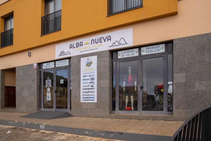
Alba Nueva Bike
2 Calle Melchor Pérez CalderónRent a mountain bike in neighbouring Puntallana
https://www.albanuevabike.com/en/
and make a trip on one of the trails in the neighbourhood
https://www.wikiloc.com/trails/mountain-biking/spain/canary-islands/puntallana
Paragliding, see the island from above, also flights from neighbouring Puntallana
https://tandemflylapalma.com/
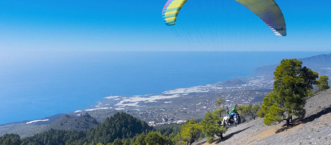
TandemFly La Palma
51 Calle EchedeyParagliding, see the island from above, also flights from neighbouring Puntallana
https://tandemflylapalma.com/
Observatory visit & Stargazing
https://lapalmastars.com/en/
Centro de Visitantes del Roque de los Muchachos
Kilometro 37 LP-4Observatory visit & Stargazing
https://lapalmastars.com/en/

Buceo Isla Bonita La Palma
Dive centre for courses & equipment
Traveler advice
Getting around
Bus stop is at 400 metres
Bus service is working very well, but will take some (waiting-)time, so look for time table and lines at https://www.tilp.es/en/take-the-bus/
What to pack
Bring boat-shoes/crocs
When going to the little natural beaches around the corner, it's advisable to bring boat-shoes or 'crocs' or some sort of swimming shoe, as the beach itself is full of pebbles
Don't miss
Info for all footpaths
See which footpaths are open, or not! ...and more info/maps for hiking
https://www.senderosdelapalma.es/en/footpaths/situation-of-the-footpaths/
Book before you go
Reserve (limited) parking for Parque Caldera de Taburiente
You need to make a reservation if you want to park your car inside the 'Parque Nacional de la Caldera de Taburiente':
https://www.reservasparquesnacionales.es/real/parquesnac/usu/html/detalle-actividad-oapn.aspx?ii=6ENG&cen=4&act=1
Don't miss
Due to micro-climates weather differs just few km's
Informing yourselves about the weather conditions per region of the island can be helpful, as it can freeze on the top, rain in another place and be warm and sunny a few km's further. There is a site with all the data, webcams included so you can watch the situations, look for: apalmet